

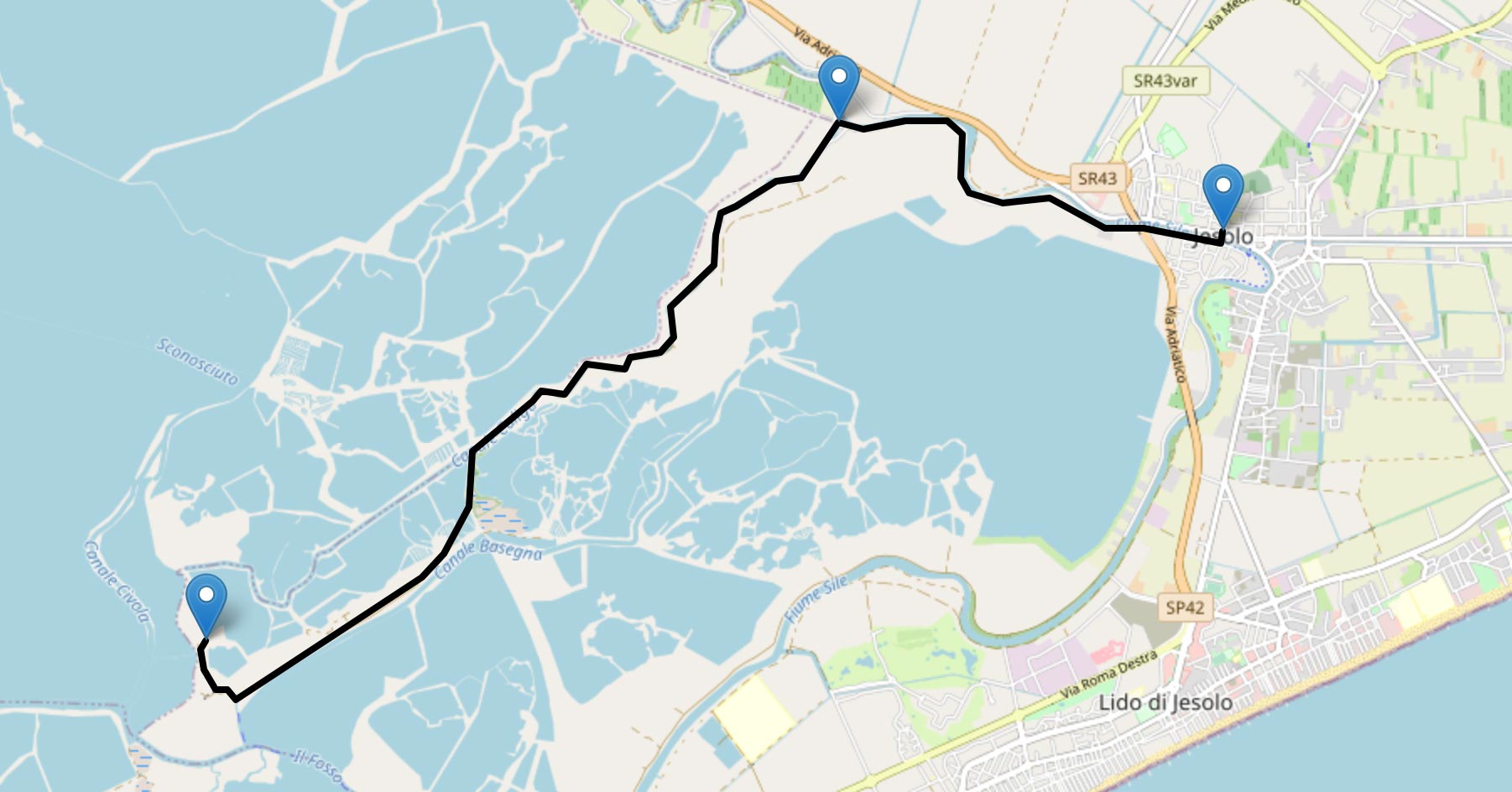
JESOLO / LIO MAGGIORE
Distance: 11.68 Km
Drop: 1 m
Slope: 0.675 %
Difficulty: easy
Type: cycle path Route: different floors Duration (15Km/h): 47 minutes
Locations
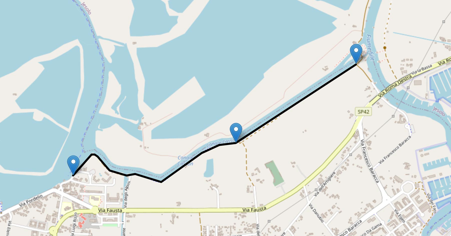
A – Itinerary start (main road, little traffic) – Municipality of Jesolo.
B – Itinerary on gravel – Municipality of Jesolo.
C – Agritourism La Barena – Municipality of Jesolo.
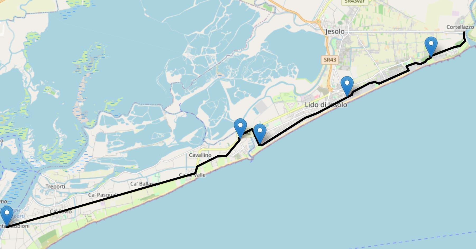
PUNTA SABBIONI / CAVALLINO / JESOLO / CORTELLAZZO
Distance: 27.53 Km
Drop: -1 m Slope: 1.26364 %
Difficulty: easy
Type: cicle path Route: pavement Duration (15Km/h): 110 minutes
Locations
A – Itinerary start Punta Sabbioni – Municipality of Cavallino Treporti
B – End of cycle path – Municipality of Cavallino Treporti
C – Start of cycle path – Municipality of Cavallino Treporti
D – End of cycle path in Piazza Marconi – Municipality of Jesolo
E – Leave main road – Municipality of Eraclea
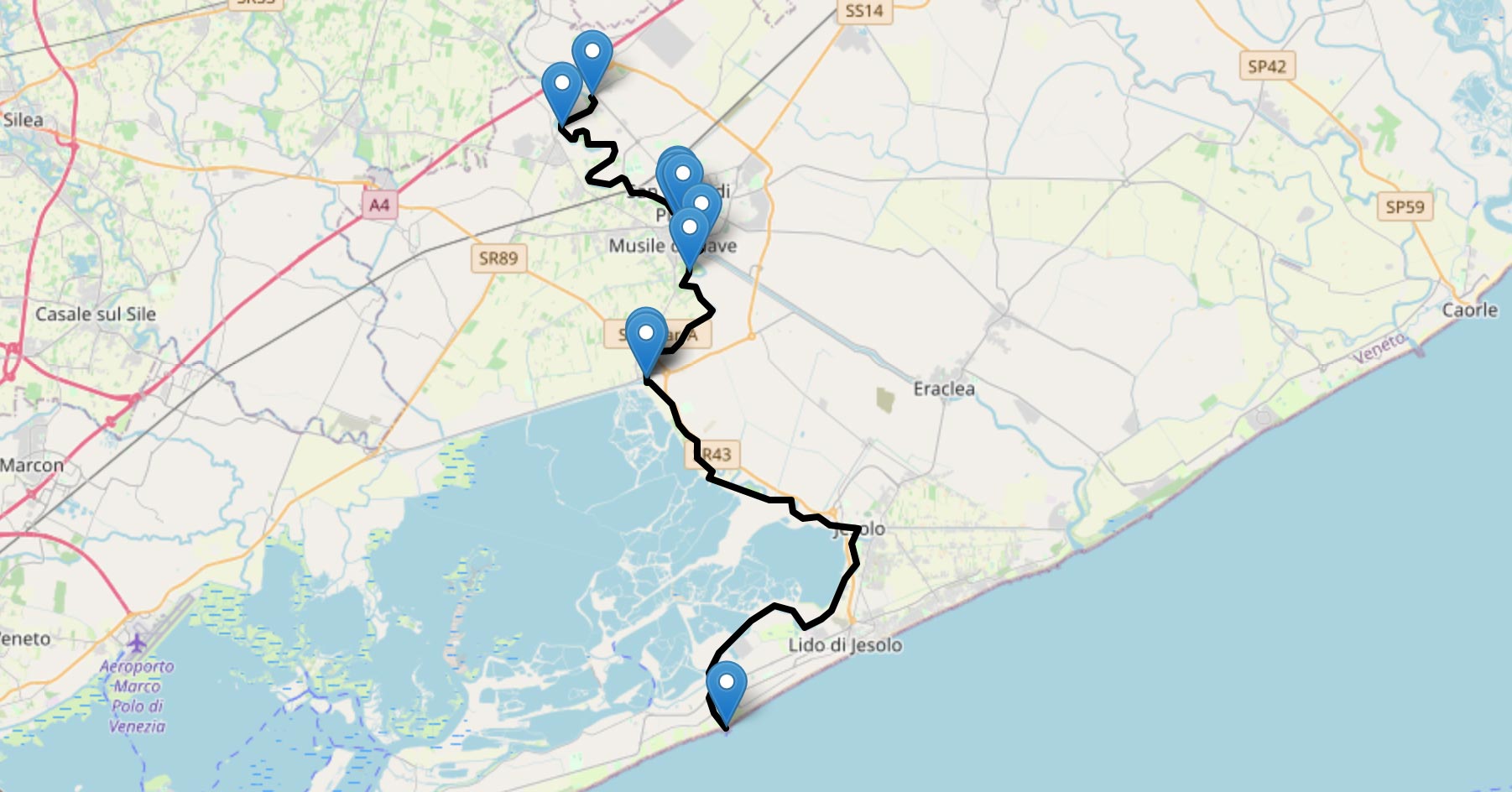
FROM THE RIVER PIAVE TO THE RIVER SILE
Distance: 36.91 Km
Drop: 2 m Slope: 0.707692 %
Difficulty: easy
Type: trail Route: different floors Duration (15 Km/h): 148 minutes
Locations
A – River park in Noventa di Piave closed to the city center – Municipality of Fossalta di Piave
B – it is possibile to take an alternative route on the other side of the river, through a bridge – Municipality of Noventa di Piave
C – End of unpaved cycle path – Municipality of Noventa di Piave
D – Cross the river Piave – Municipality of Noventa di Piave
E – Off the ramp – Municipality of Noventa di Piave
F – Start of unpaved path – Municipality of Noventa di Piave
G – End of unpaved path: cross the street and get to the city center of Musile – Municipality of Musile di Piave
H – Start of unpaved cycle path – Municipality of San Dona’ di Piave
I – Warning! Dangerous crossing – Municipality of Musile di Piave
J – Bridge in Caposile – Municipality of Musile di Piave
K – Main road – Municipality of Musile di Piave
L – End of route, Lighthouse in Cavallino – Municipality of Jesolo
PORTE DEL CAVALLINO
Distance: 2.25 Km
Drop: 1 m Slope: 0.8 %
Difficulty: easy
Type: cycle path Route: different floors
Duration (15Km/h): 9 minutes
Locations
A – Itineray start of cycle path, half pedestrian area – Municipality of Cavallino Treporti
B – End of paved cycle path, start of unpaved cycle path – Municipality of Cavallino Treporti
C – End of cycle path, you can go on on side roads (little traffic) – Municipality of Cavallino Treporti


